04/2025
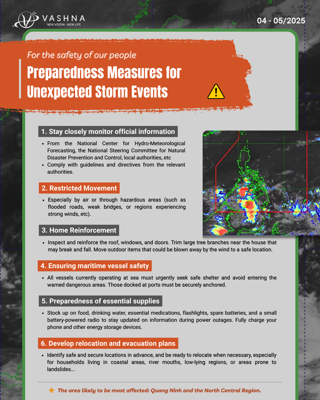
Update on the Low-Pressure Area Likely to Develop into a Storm & Important Precautionary Measures
Dear Community, in recent days, the complex weather developments in the East Sea (South China Sea) have received special attention. With the aim of providing a multi-perspective update and prioritizing community safety, Vashna Group respectfully shares the latest situation and essential recommendations based on official sources and previously shared forecasts.
1. Updates from Official Agencies on the Low-Pressure Area Likely to Intensify into a Storm:
The following information from competent authorities and mainstream media remains the most important and reliable reference. We would like to quote excerpts published by reputable news outlets:
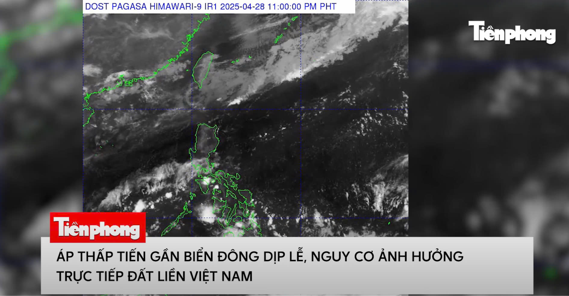
- According to reports, “Over the past days, a low-pressure area entered the Philippine area of responsibility on the morning of April 28.”
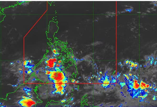
Áp thấp gần Biển Đông đã đi vào khu vực dự báo PAR của Philippines và có khả năng mạnh lên thành bão. Ảnh: PAGASA
“By the morning of April 29, the center of the tropical depression was located about 800 km east-southeast of Luzon Island (Philippines), with wind speeds of level 6–7 (39–61 km/h), gusting to level 9. Forecasts for the next 24 hours indicate the tropical depression will move west-northwest at 15–20 km/h, continue to strengthen, and may reach storm intensity as it approaches the Luzon archipelago. Afterwards, it is likely to cross Luzon and enter the East Sea (South China Sea) around May 1 or 2.”
- International experts have also provided initial assessments. Veronica Torres, a meteorologist from PAGASA (Philippine Atmospheric, Geophysical and Astronomical Services Administration), stated: “The newly formed low-pressure area near the East Sea could become the first storm of the 2025 Pacific typhoon season.” ... Meanwhile, according to Lao Dong newspaper, “Ariel Rojas-a weather forecasting expert from ABS-CBN-assessed that the low-pressure area near the East Sea may intensify into a tropical storm on April 30 or May 1. ‘The storm may pass through central Philippines towards the East Sea or curve back east of Luzon,’ he said. However, he noted that the forecast track and intensity of Storm Auring remain uncertain.”
- Regarding potential impacts on Vietnam, sources indicate: “The circulation of the tropical depression/storm may cause heavy rain, strong winds, high waves, and rough seas along the central and northern coastal provinces of Vietnam in early May. Areas from Thanh Hoa to Quang Tri may be directly affected if the storm maintains strong intensity and moves inland.” ... In response, “The National Steering Committee for Natural Disaster Prevention and Control has requested coastal localities from Quang Ninh to Khanh Hoa to closely monitor weather developments and prepare response plans should the storm form and intensify rapidly. Authorities are coordinating with the Border Guard and the transport sector to urge vessels operating offshore to quickly seek safe shelter…”
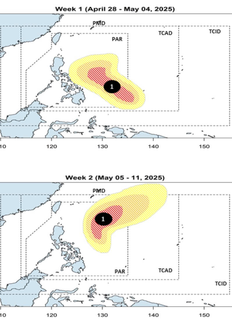
Forecast of storm developments near the East Sea formed from low pressure in the next few days. Photo: PAGASA
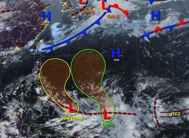
Two low pressure systems are likely to approach the East Sea in the next 2-3 days, starting from April 29, 2025. Photo: JTWC
2. Comparison with Early Forecasts from Vashna Thiên Kim:
Alongside continuously updated official information, we would also like to reiterate the early forecasts shared by Vashna Thiên Kim on April 14, 2025, to provide an additional perspective for the community:

- On April 14, Vashna Thiên Kim shared: “During today’s midday meditation, I saw a cyclone-like sound wave (STORM) heading straight towards northern Vietnam, specifically towards Quang Ninh. Based on the speed of this cyclone-like wave, I analyzed that in less than a month (from around May 4–5 onwards, possibly sooner), Quang Ninh will experience a major storm, with winds at the center possibly reaching level 12. Currently, I see the wave’s path coming in from the southeast and just beginning.”
- Regarding the scope of impact, Vashna Thiên Kim noted: “The storm entering Vietnam will cause widespread thunderstorms in the North Central region, with Quang Ninh particularly affected.” ... Further explaining the basis for observation and timing, Vashna Thiên Kim shared: “Through sensing the resonance of external frequencies from the Earth’s magnetic field, I perceive an unusual, intense sound wave, still moving towards Earth in a cyclone pattern, showing no sign of weakening or changing direction... Therefore, I recently forecast a high likelihood of a major storm making landfall, most significantly impacting Quang Ninh... According to my observations, by April 29 at the latest, meteorological agencies will detect abnormal climate changes in the northern regions to warn the public, and between May 2–4, a major storm may arise in Quang Ninh... Although this forecast previously lacked sufficient scientific basis, there is now indeed a storm forming from the east, and according to Ariel Rojas - a weather forecasting expert from ABS-CBN - it is highly likely to enter the East Sea and then make landfall. Therefore, I sincerely want to share this to help our compatriots raise vigilance and prepare timely, ahead of unpredictable natural fluctuations.
We can prepare in time; everyone hopes the storm will not make landfall, but if it does, it is better to be ready, especially for those working at sea and in maritime transport."
We note a remarkable convergence between the latest official updates and Vashna Thiên Kim’s early forecasts, especially regarding the potential storm formation from the east and the expected impact period (early May). The specific location identified by Vashna Thiên Kim as the most likely landfall is Quang Ninh, along with warnings of widespread thunderstorms in the North Central region. This warrants special attention as experts have also emphasized the complex and uncertain nature of the storm’s path.
Vashna Group is genuinely concerned by this information, and we believe that no one in Vietnam wishes for such sudden natural disasters to occur. Hoping to minimize potential damage when the storm makes landfall, this article is provided to suggest preventive measures should a storm occur in the coming days. The sole purpose of sharing and comparing this information is to give the community a multi-faceted view, raise vigilance, and encourage thorough preparation, especially for residents in areas forecasted to be affected, such as Quang Ninh and the North Central provinces.
3. Recommendations for Proactive Prevention and Response:
Natural disasters are unpredictable, and the formation and impact of a storm is something none of us desires. Therefore, Vashna Group earnestly calls upon the community, especially those in high-risk areas, to proactively implement necessary preventive measures to protect lives and property, and to minimize risks should adverse situations arise:

- Closely monitor information: Always stay updated with official forecasts and warnings from the National Center for Hydro-Meteorological Forecasting, the National Steering Committee for Natural Disaster Prevention and Control, and local authorities. Strictly follow the instructions and directives of official agencies.
- Reinforce your home: Inspect and secure roofs, windows, and doors. Trim large tree branches near your house that may break. Move outdoor items that could be blown away to a safe place.
- Ensure vessel safety: As advised by authorities, vessels operating at sea should urgently seek safe shelter and avoid entering dangerous areas as warned. Securely anchor boats at the harbor.
- Prepare essential supplies: Stock up on food, drinking water, essential medicines, flashlights, backup batteries, and a small battery-powered radio to stay informed in case of power outages. Fully charge your phone and backup power devices.
- Plan for evacuation and relocation: Identify safe, sturdy locations in advance (community centers, schools, government offices) and be ready to evacuate when instructed by local authorities, especially for households in coastal areas, river mouths, low-lying or landslide-prone areas.
- Limit travel: During days when a storm is forecast to have a direct impact, minimize going outdoors, especially by air or through dangerous areas (flooded roads, weak bridges, areas with strong winds, etc.).
Conclusion:
Vashna Group believes that thorough preparation and a proactive spirit from each individual and family are the most important factors in minimizing damage caused by natural disasters. It is important to emphasize that the early forecasts shared by Vashna Thiên Kim are based on her observation methods and are provided for reference only, to encourage preparedness and accompany the collective efforts of society-and are not a substitute for official scientific forecasts from meteorological agencies.
We respectfully urge all citizens to follow official forecasts, proactively implement necessary preventive measures closely, and strictly adhere to the guidance of local authorities.
We wish the community good health and safety, and hope that together we will overcome all difficulties.
Respectfully,
Vashna Group
Tin tức liên quan
- Vashna Thiên Kim đem văn hóa Nepal và Nhật Bản vào sự kiện Thiền trà kết nối tại Hà Nội
- Đại sứ Vashna Thiên Kim chinh phục cự ly 21km tại Giải Marathon quốc tế
- Người đẹp Cần Thơ ẵm giải một chiếc Ford EcoSport hoàn toàn mới
- Omanda Sài Gòn khai trương trong không gian “thiền” ấm áp và trang trọng
- Văn hóa Nepal và Nhật Bản hoà quyện vào sự kiện thiền trà kết nối tại Hà Nội

.jpg)